دوتنه:Atlas Van der Hagen-KW1049B12 002-HISPANIAE ET PORTUGALIAE REGNA.jpeg

اصلي دوتنه (۵٬۵۰۰ × ۴٬۵۶۳ پېکسل, د دوتنې کچه: ۴٫۳۱ مېگابايټ, MIME بڼه: image/jpeg)

دا دوتنه د ويکيمېډيا کامنز لخوا خپرېږې او کېدای شي چې دا په نورو پروژو هم کارېدلې وي. د دوتنې د کارېدنې لا نور مالومات د دوتنې د څرگندنو په مخ کې لاندې ښودل شوی.

لنډيز

Dirk Jansz van Santen: Atlas van Dirk van der Hagen (volledig, collectie KB)  wikidata:Q20754745 reasonator:Q20754745
هنرمند
Nicolaes Visscher II  (fl. ۱۶۹۰)  wikidata:Q15410601
 
نور نومونه
Nicolaes Jansz. Visscher, Nicolas Visscher
څرگندونه engraver، cartographer او publisher
زېږون نېټه/مړينه ۱۶۴۹ / ۱۶۱۸ Edit this at Wikidata ۱۷۰۲ / ۱۷۰۹ Edit this at Wikidata
زېږونځای/مړينه امسټرډام Edit this at Wikidata امسټرډام Edit this at Wikidata
د کار موده 1679–1702
د کار ځای
واک کنټرول
artist QS:P170,Q15410601

Author: Nicolaes Visscher II

Publisher:
Nicolaes Visscher II  (fl. ۱۶۹۰)  wikidata:Q15410601
 
نور نومونه
Nicolaes Jansz. Visscher, Nicolas Visscher
څرگندونه engraver، cartographer او publisher
زېږون نېټه/مړينه ۱۶۴۹ / ۱۶۱۸ Edit this at Wikidata ۱۷۰۲ / ۱۷۰۹ Edit this at Wikidata
زېږونځای/مړينه امسټرډام Edit this at Wikidata امسټرډام Edit this at Wikidata
د کار موده 1679–1702
د کار ځای
واک کنټرول
artist QS:P170,Q15410601
image of artwork listed in title parameter on this page
ليکوال

Author: Nicolaes Visscher II

Publisher:
Nicolaes Visscher II  (fl. ۱۶۹۰)  wikidata:Q15410601
 
نور نومونه
Nicolaes Jansz. Visscher, Nicolas Visscher
څرگندونه engraver، cartographer او publisher
زېږون نېټه/مړينه ۱۶۴۹ / ۱۶۱۸ Edit this at Wikidata ۱۷۰۲ / ۱۷۰۹ Edit this at Wikidata
زېږونځای/مړينه امسټرډام Edit this at Wikidata امسټرډام Edit this at Wikidata
د کار موده 1679–1702
د کار ځای
واک کنټرول
creator QS:P170,Q15410601
لقب
HISPANIAE ET PORTUGALIAE REGNA
Object type نقشه
object_type QS:P31,Q4006
څرگندونه
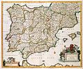
Nederlands: Deze kaart van Spanje en Portugal werd gepubliceerd door Nicolaes Visscher II (1649-1702). Het was zeker niet de eerste uitgave van de kaart. De kaart was in 1631 voor het eerst door Willem Jansz. Blaeu (1571-1638) uitgegeven, toen onder de titel: Regnorum Hispaniae. Spanje en Portugal vormden namelijk tot 1640 één koninkrijk. Toen aan deze situatie een einde kwam werd ook de titel aangepast aan de veranderde politieke situatie.
English: This map of Spain and Portugal was published by Nicolaes Visscher II (1649-1702). It was not the first issue of the map. In 1631 the map was first printed by Willem Jansz. Blaeu (1571-1638), under the title: Regnorum Hispaniae because Spain and Portugal formed one kingdom until 1640. When this ended the title had to be adapted to the new political situation.
ژبه هالنډي ژبه Edit this at Wikidata
نېټه after ۱۶۸۱
date QS:P571,+1681-00-00T00:00:00Z/7,P1319,+1681-00-00T00:00:00Z/9
خپرېدو نېټه circa  Edit this at Wikidata
منځوی
Nederlands: kopergravure
Dimensions 46 x 57 cm
institution QS:P195,Q1526131
Accession number
Description of the Atlas Van der Hagen in the catalogue of the KB: http://opc4.kb.nl/DB=1/TTL=1/LNG=EN/PPN?PPN=353012750
Place of creation Amsterdam
يادښتونه KW1049B12_002 - Volume 1
Related persons
InfoField
Nicolaes Visscher II - Willem Jansz. Blaeu
Depicted locations
InfoField
Spain - Portugal
سرچينې
سرچينه/انځورگر

Source page at the [1]; Geheugen van Nederland / Memory of the Netherlands website.

اجازه
(دا دوتنه بيا کارول)
This is a faithful photographic reproduction of a two-dimensional, public domain work of art. The work of art itself is in the public domain for the following reason:
Public domain

This work is in the public domain in its country of origin and other countries and areas where the copyright term is the author's life plus 70 years or fewer.


This work is in the public domain in the United States because it was published (or registered with the U.S. Copyright Office) before January 1, 1929.

This file has been identified as being free of known restrictions under copyright law, including all related and neighboring rights.
The official position taken by the Wikimedia Foundation is that "faithful reproductions of two-dimensional public domain works of art are public domain".
This photographic reproduction is therefore also considered to be in the public domain in the United States. In other jurisdictions, re-use of this content may be restricted; see Reuse of PD-Art photographs for details.

Captions

Add a one-line explanation of what this file represents
Map of Spain and Portugal

Items portrayed in this file

depicts انګليسي

Mallorca انګليسي

Menorca انګليسي

compass rose انګليسي

fleur-de-lis انګليسي

angel انګليسي

putto انګليسي

wind wave انګليسي

crown انګليسي

sceptre انګليسي

sandal انګليسي

crown انګليسي

chain of office انګليسي

Golden Fleece انګليسي

palm branch انګليسي

lion انګليسي

tower انګليسي

belt انګليسي

cloak انګليسي

robe انګليسي

column انګليسي

copyright status انګليسي

public domain انګليسي

media type انګليسي

image/jpeg

checksum انګليسي

c388277bdd8e005ab1129d322d17ca6204f407f4

data size انګليسي

۴٬۵۱۸٬۰۷۵ بايټ

height انګليسي

۴٬۵۶۳ پېکسل

width انګليسي

۵٬۵۰۰ پېکسل

د دوتنې پېښليک

په يوې نېټې/يوه وخت وټوکۍ چې د هماغه وخت او نېټې دوتنه چې څنگه ښکارېده هماغسې درښکاره شي.

نېټه/وختبټنوکډډېکارنتبصره
اوسنی۱۱:۰۰, ۱۸ جولای ۲۰۱۵د ۱۱:۰۰, ۱۸ جولای ۲۰۱۵ پورې د بټنوک بڼه۵٬۵۰۰ × ۴٬۵۶۳ (۴٫۳۱ مېگابايټ)OlafJanssenGWToolset: Creating mediafile for OlafJanssen.

دا لاندينی مخ د همدې دوتنې سره تړنې لري:

د نړېوالې دوتنې کارېدنه

همدا دوتنه لاندينۍ نورې ويکي گانې کاروي:

د دې دوتنې نورې نړېوالې کارېدنې کتل.

مېټاډاټا