دوتنه:Buryatia02.png

د همدې ليدنې کچه: ۸۰۰ × ۵۶۷ پېکسل. نورې ژورليدنې: ۳۲۰ × ۲۲۷ پېکسل | ۶۴۰ × ۴۵۴ پېکسل | ۱٬۰۶۶ × ۷۵۶ پېکسل.
اصلي دوتنه (۱٬۰۶۶ × ۷۵۶ پېکسل, د دوتنې کچه: ۴۹ کيلوبايټ, MIME بڼه: image/png)
لنډيز
| څرگندونه |
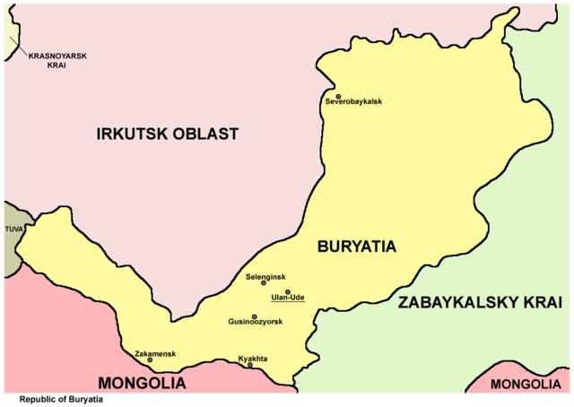
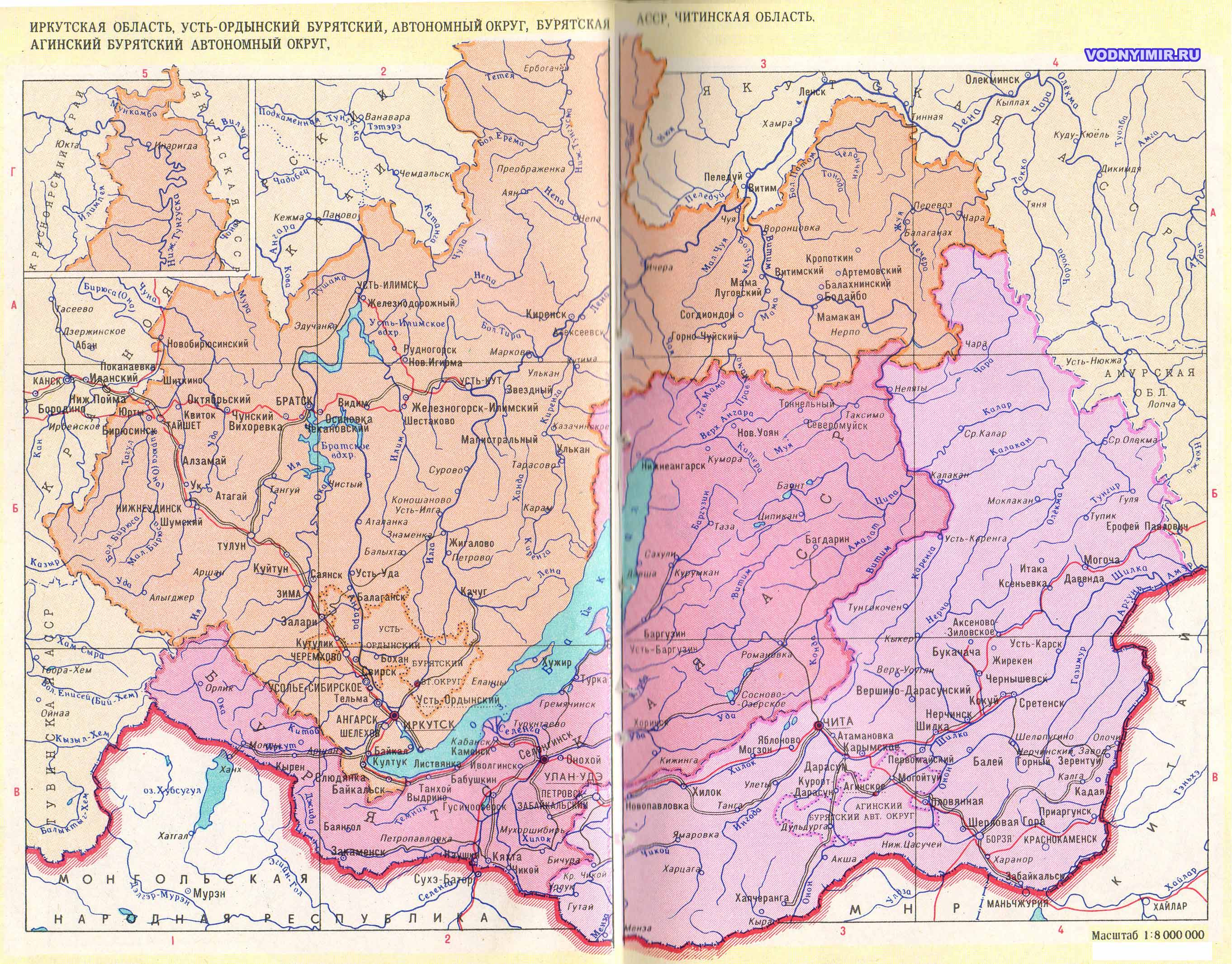
English: Map of the Republic of Buryatia, Russia. |
| نېټه | |
| سرچينه | شخصي اثر |
| ليکوال | PANONIAN |
منښتليک:
زه، د دې اثر د خپرولو او لمېسلو خاوند، دا دوتنه د لاندې منښتليک پر بنسټ دلته خپروم:
| This file is made available under the Creative Commons CC0 1.0 Universal Public Domain Dedication. | |
| The person who associated a work with this deed has dedicated the work to the public domain by waiving all of their rights to the work worldwide under copyright law, including all related and neighboring rights, to the extent allowed by law. You can copy, modify, distribute and perform the work, even for commercial purposes, all without asking permission.
|
References
Maps from external links:
- http://planetolog.ru/maps/russia-oblast/Buryatia.jpg
- http://freemedline.ru/userfiles/map_burat.gif[dead link]
- http://www.sbaikal.ru/pic/tourism/mapbur.gif
- http://www.hge.pu.ru/mapgis/subekt/buryat/buryat.gif
- http://www.ruschamber.net/Logos/Articles/1400/buryatia.gif archive copy at the Wayback Machine
- http://trasa.ru/img/regions/buriatiya.gif
- http://loi.sscc.ru/bdm/nso/attr/sfo/img/buryatia.gif archive copy at the Wayback Machine
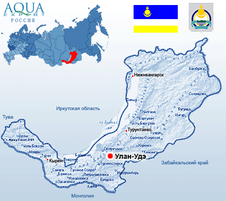
- http://www.aquaexpert.ru/id_pict/region_11.gif
- http://www.svyato.info/uploads/map/burjatija-respublika.gif archive copy at the Wayback Machine
- http://rosavtodor.ru/doc/dorognye_fondy/buryatiya_b.jpg archive copy at the Wayback Machine
- http://www.regions.newsall.ru/buriatia/Buriaia.gif
- http://dic.academic.ru/pictures/enc_geo/Buryatia.jpg
- http://vsemirniysledopyt.ru/i/58/164158/i_001.png
- http://www.mapzones.com/citymap/russia/republic_of_buryatia/republic_of_buryatia.jpg
- http://rdaward.org/map/0o.jpg
- http://files.vector-images.com/clipart/buryatia_map.gif archive copy at the Wayback Machine
- http://www.stalvik.com/images/Kartor/karta_burjatien.jpg
- http://russiaprofile.org/p-38660-cur_image.ajax?media_id=3811&_=1295871887 archive copy at the Wayback Machine
- http://www.ulan-medium.com/wp-content/uploads/2012/03/Buryatia.jpg
- http://ars.sciencedirect.com/content/image/1-s2.0-S0269749106003782-gr1.jpg[dead link]
- http://museum.gulagmemories.eu/sites/default/files/Buriatia_F.jpg
- http://www.vodnyimir.ru/images/map/Irkutskaya_obl.jpg
Largest cities and towns in Buryatia:
- http://world-gazetteer.com/wg.php?x=&men=gcis&lng=en&des=wg&geo=-183&srt=npan&col=abcdefghinoq&msz=1500&geo=-3098[dead link]
د دوتنې پېښليک
په يوې نېټې/يوه وخت وټوکۍ چې د هماغه وخت او نېټې دوتنه چې څنگه ښکارېده هماغسې درښکاره شي.
| نېټه/وخت | بټنوک | ډډې | کارن | تبصره | |
|---|---|---|---|---|---|
| اوسنی | ۰۹:۲۷, ۱۰ اگسټ ۲۰۱۲ | | ۱٬۰۶۶ × ۷۵۶ (۴۹ کيلوبايټ) | PANONIAN | {{Information |Description ={{en|1=Map of the Republic of Buryatia, Russia.}} |Source ={{own}} |Author =PANONIAN |Date =2012 |Permission = |other_versions = }} |
د دوتنې کارېدنه
دا لاندينی مخ د همدې دوتنې سره تړنې لري:
د نړېوالې دوتنې کارېدنه
همدا دوتنه لاندينۍ نورې ويکي گانې کاروي:
- په ace.wikipedia.org کارونې
- په an.wikipedia.org کارونې
- په ast.wikipedia.org کارونې
- په az.wikipedia.org کارونې
- په be-tarask.wikipedia.org کارونې
- په br.wikipedia.org کارونې
- په bs.wikipedia.org کارونې
- په bxr.wikipedia.org کارونې
- په cs.wikipedia.org کارونې
- په cv.wikipedia.org کارونې
- په da.wikipedia.org کارونې
- په de.wikipedia.org کارونې
- په en.wikipedia.org کارونې
- په eo.wikipedia.org کارونې
- په es.wikipedia.org کارونې
- په eu.wikipedia.org کارونې
- په fa.wikipedia.org کارونې
- په fi.wikipedia.org کارونې
- په ga.wikipedia.org کارونې
- په gl.wikipedia.org کارونې
- په hi.wikipedia.org کارونې
- په hr.wikipedia.org کارونې
- په hu.wikipedia.org کارونې
- په ja.wikipedia.org کارونې
- په ka.wikipedia.org کارونې
- په koi.wikipedia.org کارونې
- په ko.wikipedia.org کارونې
- په lb.wikipedia.org کارونې
- په lt.wikipedia.org کارونې
- په mk.wikipedia.org کارونې
- په mr.wikipedia.org کارونې
- په ms.wikipedia.org کارونې
- په myv.wikipedia.org کارونې
- په nl.wikipedia.org کارونې
- په nn.wikipedia.org کارونې
- په pam.wikipedia.org کارونې
- په pl.wikipedia.org کارونې
- په pnb.wikipedia.org کارونې
- په pt.wikipedia.org کارونې
- په ro.wikipedia.org کارونې
- په sah.wikipedia.org کارونې
- په sco.wikipedia.org کارونې
- په se.wikipedia.org کارونې
- په sh.wikipedia.org کارونې
- په sk.wikipedia.org کارونې
- په sl.wikipedia.org کارونې
- په sr.wikipedia.org کارونې
- په su.wikipedia.org کارونې
- په sv.wikipedia.org کارونې
- په szl.wikipedia.org کارونې
د دې دوتنې نورې نړېوالې کارېدنې کتل.