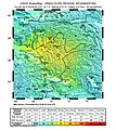
دوتنه:Shakemap us10003re5 highres.jpg

د همدې ليدنې کچه: ۵۳۲ × ۵۹۹ پېکسل. نورې ژورليدنې: ۲۱۳ × ۲۴۰ پېکسل | ۴۲۶ × ۴۸۰ پېکسل | ۶۸۲ × ۷۶۸ پېکسل | ۹۰۹ × ۱٬۰۲۴ پېکسل | ۲٬۵۵۰ × ۲٬۸۷۱ پېکسل.
اصلي دوتنه (۲٬۵۵۰ × ۲٬۸۷۱ پېکسل, د دوتنې کچه: ۵٫۵۵ مېگابايټ, MIME بڼه: image/jpeg)
د دوتنې پېښليک
په يوې نېټې/يوه وخت وټوکۍ چې د هماغه وخت او نېټې دوتنه چې څنگه ښکارېده هماغسې درښکاره شي.
| نېټه/وخت | بټنوک | ډډې | کارن | تبصره | |
|---|---|---|---|---|---|
| اوسنی | ۲۰:۱۹, ۲۸ اکتوبر ۲۰۱۵ |  | ۲٬۵۵۰ × ۲٬۸۷۱ (۵٫۵۵ مېگابايټ) | Kiwi128 | Cropped |
| ۲۰:۱۶, ۲۸ اکتوبر ۲۰۱۵ |  | ۲٬۵۵۰ × ۳٬۳۰۰ (۵٫۵۵ مېگابايټ) | Kiwi128 | User created page with UploadWizard |
د دوتنې کارېدنه
دا لاندينی مخ د همدې دوتنې سره تړنې لري:
د نړېوالې دوتنې کارېدنه
همدا دوتنه لاندينۍ نورې ويکي گانې کاروي:
- په ar.wikipedia.org کارونې
- په bs.wikipedia.org کارونې
- په ca.wikipedia.org کارونې
- په de.wikipedia.org کارونې
- په en.wikipedia.org کارونې
- په es.wikipedia.org کارونې
- په eu.wikipedia.org کارونې
- په fa.wikipedia.org کارونې
- په fr.wikipedia.org کارونې
- په hi.wikipedia.org کارونې
- په hr.wikipedia.org کارونې
- په hu.wikipedia.org کارونې
- په id.wikipedia.org کارونې
- په ja.wikipedia.org کارونې
- په my.wikipedia.org کارونې
- په pa.wikipedia.org کارونې
- په pl.wikipedia.org کارونې
- په pnb.wikipedia.org کارونې
- په pt.wikipedia.org کارونې
- په ru.wikipedia.org کارونې
- په sh.wikipedia.org کارونې
- په ta.wikipedia.org کارونې
- په ta.wikinews.org کارونې
- په th.wikipedia.org کارونې
- په uk.wikipedia.org کارونې
- په ur.wikipedia.org کارونې
- په vi.wikipedia.org کارونې
- په www.wikidata.org کارونې
- په zh.wikipedia.org کارونې
