دوتنه:Santa lucia castries political.png

د همدې ليدنې کچه: ۴۲۴ × ۵۹۹ پېکسل. نورې ژورليدنې: ۱۷۰ × ۲۴۰ پېکسل | ۳۳۹ × ۴۸۰ پېکسل | ۷۳۳ × ۱٬۰۳۶ پېکسل.
اصلي دوتنه (۷۳۳ × ۱٬۰۳۶ پېکسل, د دوتنې کچه: ۲۰ کيلوبايټ, MIME بڼه: image/png)
لنډيز
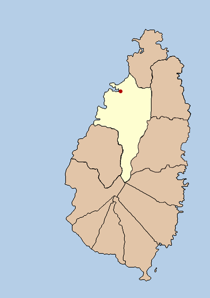
| څرگندونه | this is a political map showing the quarter of Castries on the island nation of Santa Lucia. I created it myself by using the GIMP to trace a public domain map that i found at the Perry-Castañeda Library Map Collection. |
| نېټه | ۲۱ سپټمبر ۲۰۰۵ (original upload date) |
| سرچينه | No machine-readable source provided. Own work assumed (based on copyright claims). |
| ليکوال | No machine-readable author provided. Doviende~commonswiki assumed (based on copyright claims). |
منښتليک:
| I, the copyright holder of this work, release this work into the public domain. This applies worldwide. In some countries this may not be legally possible; if so: I grant anyone the right to use this work for any purpose, without any conditions, unless such conditions are required by law. |

|
File:Saint Lucia district of Castries.svg is a vector version of this file. It should be used in place of this PNG file when not inferior.
File:Santa lucia castries political.png → File:Saint Lucia district of Castries.svg
For more information, see Help:SVG. |
 |
د دوتنې پېښليک
په يوې نېټې/يوه وخت وټوکۍ چې د هماغه وخت او نېټې دوتنه چې څنگه ښکارېده هماغسې درښکاره شي.
| نېټه/وخت | بټنوک | ډډې | کارن | تبصره | |
|---|---|---|---|---|---|
| اوسنی | ۰۳:۴۳, ۲۱ سپټمبر ۲۰۰۵ | | ۷۳۳ × ۱٬۰۳۶ (۲۰ کيلوبايټ) | Doviende~commonswiki | this is a political map showing the quarter of Castries on the island nation of Santa Lucia. I created it myself by using the GIMP to trace [http://www.lib.utexas.edu/maps/americas/saint_lucia.gif a public domain map that i found] at the Perry-Casta� |
د دوتنې کارېدنه
دا لاندينی مخ د همدې دوتنې سره تړنې لري:
د نړېوالې دوتنې کارېدنه
همدا دوتنه لاندينۍ نورې ويکي گانې کاروي:
- په af.wikipedia.org کارونې
- په am.wikipedia.org کارونې
- په ban.wikipedia.org کارونې
- په cy.wikipedia.org کارونې
- په en.wikipedia.org کارونې
- په fa.wikipedia.org کارونې
- په fi.wikipedia.org کارونې
- په hr.wikipedia.org کارونې
- په hu.wikipedia.org کارونې
- په id.wikipedia.org کارونې
- په incubator.wikimedia.org کارونې
- په ja.wikipedia.org کارونې
- په ko.wikipedia.org کارونې
- په mk.wikipedia.org کارونې
- په ml.wikipedia.org کارونې
- په mr.wikipedia.org کارونې
- په nl.wikipedia.org کارونې
- په nn.wikipedia.org کارونې
- په sah.wikipedia.org کارونې
- په sh.wikipedia.org کارونې
- په sv.wikipedia.org کارونې
- په ta.wikipedia.org کارونې
- په th.wikipedia.org کارونې
- په tr.wikipedia.org کارونې
- په ur.wikipedia.org کارونې
- په vi.wikipedia.org کارونې
- په yo.wikipedia.org کارونې
- په zh-min-nan.wikipedia.org کارونې