دوتنه:Santa Cruz County Incorporated and Unincorporated areas Nogales highlighted.svg

Size of this PNG preview of this SVG file: ۸۰۰ × ۴۲۴ پېکسل. نورې ژورليدنې: ۳۲۰ × ۱۶۹ پېکسل | ۶۴۰ × ۳۳۹ پېکسل | ۱٬۰۲۴ × ۵۴۲ پېکسل | ۱٬۲۸۰ × ۶۷۸ پېکسل | ۲٬۵۶۰ × ۱٬۳۵۵ پېکسل | ۸۵۰ × ۴۵۰ پېکسل.
اصلي دوتنه (SVG دوتنه، نومېنلي ۸۵۰ × ۴۵۰ پېکسل، د دوتنې کچه: ۴۱ کيلوبايټ)
لنډيز
| څرگندونه |
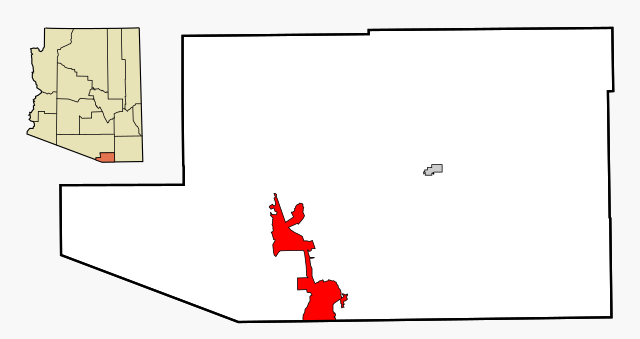
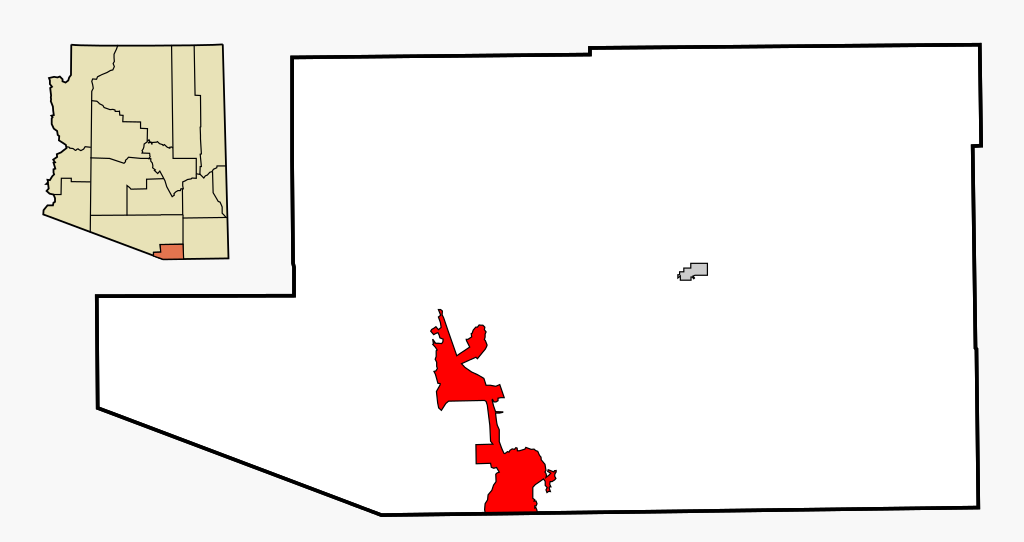
This map shows the incorporated areas and unincorporated areas in Santa Cruz County, Arizona.
|
| نېټه | |
| سرچينه | My own work, based on public domain information |
| ليکوال | Ixnayonthetimmay |
| اجازه (دا دوتنه بيا کارول) |
All rights not reserved. See below. |
| نورې بڼې | See Category:Maps of Santa Cruz County for other versions of this image. |
منښتليک:
| I, the copyright holder of this work, release this work into the public domain. This applies worldwide. In some countries this may not be legally possible; if so: I grant anyone the right to use this work for any purpose, without any conditions, unless such conditions are required by law. |
د دوتنې پېښليک
په يوې نېټې/يوه وخت وټوکۍ چې د هماغه وخت او نېټې دوتنه چې څنگه ښکارېده هماغسې درښکاره شي.
| نېټه/وخت | بټنوک | ډډې | کارن | تبصره | |
|---|---|---|---|---|---|
| اوسنی | ۰۲:۵۵, ۳ مارچ ۲۰۰۷ | | ۸۵۰ × ۴۵۰ (۴۱ کيلوبايټ) | Ixnayonthetimmay | {{Information |Description=This map shows the incorporated areas and unincorporated areas in Santa Cruz County, Arizona. Nogales i |
د دوتنې کارېدنه
دا لاندينی مخ د همدې دوتنې سره تړنې لري:
د نړېوالې دوتنې کارېدنه
همدا دوتنه لاندينۍ نورې ويکي گانې کاروي:
- په ar.wikipedia.org کارونې
- په arz.wikipedia.org کارونې
- په ca.wikipedia.org کارونې
- په ceb.wikipedia.org کارونې
- په cy.wikipedia.org کارونې
- په eu.wikipedia.org کارونې
- په fa.wikipedia.org کارونې
- په fr.wikipedia.org کارونې
- په ht.wikipedia.org کارونې
- په hu.wikipedia.org کارونې
- په id.wikipedia.org کارونې
- په pt.wikipedia.org کارونې
- په ro.wikipedia.org کارونې
- په sr.wikipedia.org کارونې
- په sv.wikipedia.org کارونې
- په tt.wikipedia.org کارونې
- په vo.wikipedia.org کارونې
- په www.wikidata.org کارونې
- په zh-min-nan.wikipedia.org کارونې