دوتنه:Map of the world by the US Gov as of 2016 no legend.svg

Size of this PNG preview of this SVG file: ۸۰۰ × ۴۰۵ پېکسل. نورې ژورليدنې: ۳۲۰ × ۱۶۲ پېکسل | ۶۴۰ × ۳۲۴ پېکسل | ۱٬۰۲۴ × ۵۱۹ پېکسل | ۱٬۲۸۰ × ۶۴۸ پېکسل | ۲٬۵۶۰ × ۱٬۲۹۷ پېکسل | ۳٬۴۶۴ × ۱٬۷۵۵ پېکسل.
اصلي دوتنه (SVG دوتنه، نومېنلي ۳٬۴۶۴ × ۱٬۷۵۵ پېکسل، د دوتنې کچه: ۲۱٫۶۱ مېگابايټ)
لنډيز
| څرگندونه |
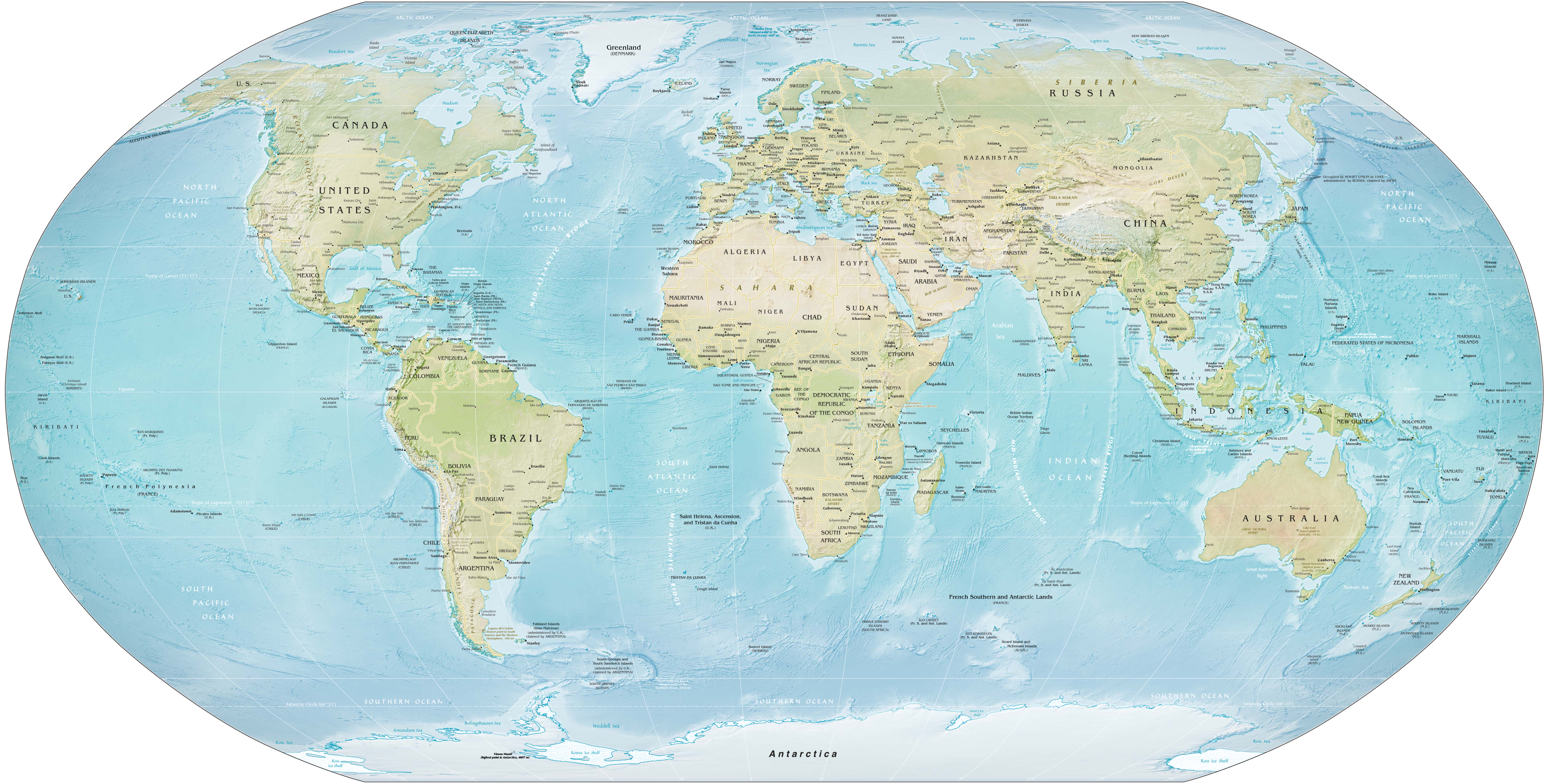
English: Map of the world as of February 2016. Robinson projection, standard parallels 38°N and 38°S. |
||
| نېټه | |||
| سرچينه | Derivative of Map of the world by the US Gov as of 2016.svg; originally from CIA World Factbook. | ||
| ليکوال | US Government, Central Intelligence Agency | ||
| نورې بڼې |
|
||
| SVG genesis |
|

|
منښتليک:
This work is in the public domain in the United States because it is a work prepared by an officer or employee of the United States Government as part of that person’s official duties under the terms of Title 17, Chapter 1, Section 105 of the US Code.
Note: This only applies to original works of the Federal Government and not to the work of any individual U.S. state, territory, commonwealth, county, municipality, or any other subdivision. This template also does not apply to postage stamp designs published by the United States Postal Service since 1978. (See § 313.6(C)(1) of Compendium of U.S. Copyright Office Practices). It also does not apply to certain US coins; see The US Mint Terms of Use.
|
 | |
| This file has been identified as being free of known restrictions under copyright law, including all related and neighboring rights. | ||
د دوتنې پېښليک
په يوې نېټې/يوه وخت وټوکۍ چې د هماغه وخت او نېټې دوتنه چې څنگه ښکارېده هماغسې درښکاره شي.
| نېټه/وخت | بټنوک | ډډې | کارن | تبصره | |
|---|---|---|---|---|---|
| اوسنی | ۱۷:۱۲, ۲۸ جنوري ۲۰۲۱ | | ۳٬۴۶۴ × ۱٬۷۵۵ (۲۱٫۶۱ مېگابايټ) | Ravenpuff | Fix clip |
| ۱۶:۵۱, ۲۸ جنوري ۲۰۲۱ |  | ۳٬۴۶۴ × ۱٬۷۵۵ (۲۱٫۶۱ مېگابايټ) | Ravenpuff | Clip out white background from raster image of map | |
| ۰۴:۱۹, ۹ جولای ۲۰۱۹ |  | ۳٬۴۶۴ × ۱٬۷۵۵ (۲۱٫۶ مېگابايټ) | Kaldari | Fixing label for Rub' al Khali Desert | |
| ۱۵:۳۲, ۸ جولای ۲۰۱۹ |  | ۳٬۴۶۴ × ۱٬۷۵۵ (۲۱٫۶ مېگابايټ) | Kaldari | Removing random square under Ross Sea label | |
| ۱۵:۱۶, ۸ جولای ۲۰۱۹ |  | ۳٬۴۶۴ × ۱٬۷۵۵ (۲۱٫۴۲ مېگابايټ) | Kaldari | User created page with UploadWizard |
د دوتنې کارېدنه
دا لاندينی مخ د همدې دوتنې سره تړنې لري:
د نړېوالې دوتنې کارېدنه
همدا دوتنه لاندينۍ نورې ويکي گانې کاروي:
- په ar.wikipedia.org کارونې
- په bbc.wikipedia.org کارونې
- په bcl.wikipedia.org کارونې
- په bn.wikipedia.org کارونې
- په br.wikipedia.org کارونې
- په bs.wikipedia.org کارونې
- په en.wikipedia.org کارونې
- Talk:Robinson projection
- Wikipedia:Featured pictures/Diagrams, drawings, and maps/Maps
- Wikipedia:Featured picture candidates/July-2019
- Wikipedia:Featured pictures thumbs/65
- Wikipedia:Featured picture candidates/Map of the world by the US Gov
- User talk:Kaldari/Archive 24
- Wikipedia:Picture of the day/February 2021
- Template:POTD/2021-02-01
- User:Northamerica1000/Topics
- Portal:Geography/Selected picture
- Wikipedia:Main Page history/2021 February 1
- Wikipedia:Main Page history/2021 February 1b
- User:Kuevans/Introduction to Comparative Politics
- په es.wikipedia.org کارونې
- په ff.wikipedia.org کارونې
- په ha.wikipedia.org کارونې
- په hi.wikipedia.org کارونې
- په hi.wikibooks.org کارونې
- په hy.wikipedia.org کارونې
- په id.wiktionary.org کارونې
- په incubator.wikimedia.org کارونې
- په mk.wikipedia.org کارونې
- په ms.wikipedia.org کارونې
- په si.wikipedia.org کارونې
- په vec.wikipedia.org کارونې
- په za.wikipedia.org کارونې
- په zh.wikipedia.org کارونې