دوتنه:Locator map of North Korea.svg

Size of this PNG preview of this SVG file: ۲۵۰ × ۱۱۵ پېکسل. نورې ژورليدنې: ۳۲۰ × ۱۴۷ پېکسل | ۶۴۰ × ۲۹۴ پېکسل | ۱٬۰۲۴ × ۴۷۱ پېکسل | ۱٬۲۸۰ × ۵۸۹ پېکسل | ۲٬۵۶۰ × ۱٬۱۷۸ پېکسل.
اصلي دوتنه (SVG دوتنه، نومېنلي ۲۵۰ × ۱۱۵ پېکسل، د دوتنې کچه: ۱٫۱۸ مېگابايټ)
لنډيز
| څرگندونه |
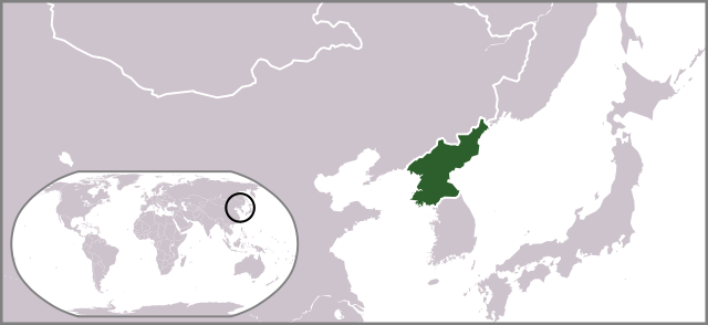
English: Locator map of North Korea. |
| نېټه | |
| سرچينه | شخصي اثر |
| ليکوال | Ksiom |
| نورې بڼې |
Derivative works of this file: Locator map of North Korea 1945-50.svg  |
منښتليک:
| I, the copyright holder of this work, release this work into the public domain. This applies worldwide. In some countries this may not be legally possible; if so: I grant anyone the right to use this work for any purpose, without any conditions, unless such conditions are required by law. |
د دوتنې پېښليک
په يوې نېټې/يوه وخت وټوکۍ چې د هماغه وخت او نېټې دوتنه چې څنگه ښکارېده هماغسې درښکاره شي.
| نېټه/وخت | بټنوک | ډډې | کارن | تبصره | |
|---|---|---|---|---|---|
| اوسنی | ۱۷:۳۴, ۱۰ جولای ۲۰۰۹ | | ۲۵۰ × ۱۱۵ (۱٫۱۸ مېگابايټ) | Ksiom | revised version |
| ۲۰:۲۹, ۱۹ اکتوبر ۲۰۰۸ |  | ۲۵۰ × ۱۱۵ (۱٫۳۴ مېگابايټ) | Ksiom | {{Information |Description={{en|1=Locator map of North Korea.}} |Source=Own work by uploader |Author=Ksiom |Date=2008-10-20 |Permission= |other_versions=Image:LocationNorthKorea.png }} <!--{{ImageUpload|full}}--> [[Category:Locator ma |
د دوتنې کارېدنه
دا 2 لانديني مخونه د همدې دوتنې سره تړنې لري:
د نړېوالې دوتنې کارېدنه
همدا دوتنه لاندينۍ نورې ويکي گانې کاروي:
- په as.wikipedia.org کارونې
- په az.wikipedia.org کارونې
- په bg.wikipedia.org کارونې
- په blk.wiktionary.org کارونې
- په bn.wikipedia.org کارونې
- په ca.wikipedia.org کارونې
- په de.wikipedia.org کارونې
- په de.wikinews.org کارونې
- په el.wikinews.org کارونې
- Ο ηγέτης της Βόρειας Κορέας ανήγγειλε ειρήνη με τη Νότιο Κορέα
- Πρότυπο:ΒόρειαΚορέα
- Τεχνητή σεισμική δόνηση στη Βόρεια Κορέα
- Η Βόρεια Κορέα ετοιμάζει για νέες πυρηνικές δοκιμές
- Οι προϋποθέσεις που έθεσε η Βόρεια Κορέα για την έναρξη συνομιλιών
- Σε εκτόξευση πυραύλου από υποβρύχιο προχώρησε η Βόρεια Κορέα
- Η Βόρεια Κορέα γιορτάζει την 105η επέτειο της γέννησης του Κιμ Ιλ Σουνγκ
- Εκτόξευση πυραύλου από τη Βόρεια Κορέα
- Η Ρωσία χρησιμοποίησε το δικαίωμα αρνησικυρίας για να αποτρέψει ψήφισμα του ΟΗΕ κατά της Βορείου Κορέας
- Χαμηλώνει η ένταση στην Κορεατική Χερσόνησο
- Καταδίκη της Βορείου Κορέας από το Συμβούλιο Ασφαλείας του ΟΗΕ
- په en.wikipedia.org کارونې
- په es.wikipedia.org کارونې
- په fa.wikipedia.org کارونې
- په fa.wikinews.org کارونې
- په fiu-vro.wikipedia.org کارونې
- په fr.wikinews.org کارونې
- په fr.wiktionary.org کارونې
- په gu.wikipedia.org کارونې
- په hif.wikipedia.org کارونې
- په id.wikipedia.org کارونې
- په it.wikivoyage.org کارونې
- په jam.wikipedia.org کارونې
- په ja.wikipedia.org کارونې
- په ja.wikinews.org کارونې
- په ja.wiktionary.org کارونې
- په ko.wikipedia.org کارونې
- په ko.wiktionary.org کارونې
- په kv.wikipedia.org کارونې
- په lo.wikipedia.org کارونې
- په mai.wikipedia.org کارونې
- په map-bms.wikipedia.org کارونې
د دې دوتنې نورې نړېوالې کارېدنې کتل.