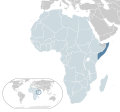
دوتنه:Location Somalia AU Africa.svg

Size of this PNG preview of this SVG file: ۶۴۶ × ۶۰۰ پېکسل. نورې ژورليدنې: ۲۵۸ × ۲۴۰ پېکسل | ۵۱۷ × ۴۸۰ پېکسل | ۸۲۷ × ۷۶۸ پېکسل | ۱٬۱۰۳ × ۱٬۰۲۴ پېکسل | ۲٬۲۰۶ × ۲٬۰۴۸ پېکسل | ۱٬۴۰۰ × ۱٬۳۰۰ پېکسل.
اصلي دوتنه (SVG دوتنه، نومېنلي ۱٬۴۰۰ × ۱٬۳۰۰ پېکسل، د دوتنې کچه: ۲٫۱۷ مېگابايټ)
د دوتنې پېښليک
په يوې نېټې/يوه وخت وټوکۍ چې د هماغه وخت او نېټې دوتنه چې څنگه ښکارېده هماغسې درښکاره شي.
| نېټه/وخت | بټنوک | ډډې | کارن | تبصره | |
|---|---|---|---|---|---|
| اوسنی | ۲۲:۲۸, ۱۶ فبروري ۲۰۲۲ |  | ۱٬۴۰۰ × ۱٬۳۰۰ (۲٫۱۷ مېگابايټ) | Jonas1015119 | Reverted to version as of 04:41, 17 February 2017 (UTC) Somaliland is not a recognized country, this are the official borders or Somalia. Make a new file if you want to have the other map, not this one which is widely used. |
| ۲۳:۲۰, ۱۵ فبروري ۲۰۲۱ |  | ۱٬۴۰۰ × ۱٬۳۰۰ (۲٫۱۱ مېگابايټ) | Jacob300 | Reverted to version as of 18:07, 29 January 2021 (UTC) | |
| ۱۲:۰۵, ۹ فبروري ۲۰۲۱ |  | ۱٬۴۰۰ × ۱٬۳۰۰ (۲٫۱۷ مېگابايټ) | Miiska sare | Reverted to version as of 22:45, 26 January 2021 (UTC) | |
| ۱۸:۰۷, ۲۹ جنوري ۲۰۲۱ |  | ۱٬۴۰۰ × ۱٬۳۰۰ (۲٫۱۱ مېگابايټ) | Jacob300 | Reverted to version as of 19:21, 24 October 2020 (UTC) | |
| ۲۲:۴۵, ۲۶ جنوري ۲۰۲۱ |  | ۱٬۴۰۰ × ۱٬۳۰۰ (۲٫۱۷ مېگابايټ) | HSA777 | Reverted to version as of 04:41, 17 February 2017 (UTC) | |
| ۱۹:۲۱, ۲۴ اکتوبر ۲۰۲۰ |  | ۱٬۴۰۰ × ۱٬۳۰۰ (۲٫۱۱ مېگابايټ) | Jacob300 | Updated map to show Somaliland | |
| ۰۴:۴۱, ۱۷ فبروري ۲۰۱۷ |  | ۱٬۴۰۰ × ۱٬۳۰۰ (۲٫۱۷ مېگابايټ) | Chipmunkdavis | Updating Morocco | |
| ۱۹:۵۸, ۲ اگسټ ۲۰۱۳ |  | ۱٬۴۰۰ × ۱٬۳۰۰ (۲٫۱۷ مېگابايټ) | Flappiefh | Added South Sudan. | |
| ۱۲:۰۳, ۳۰ جولای ۲۰۰۹ |  | ۱٬۴۰۰ × ۱٬۳۰۰ (۲٫۱۷ مېگابايټ) | Alvaro1984 18 | {{Information |Description={{es|1=Mapa de Somalia}} {{en|1=Map of Somalia}} |Source=trabajo propio (own work) |Author=Alvaro1984 18 |Date=30/07/2009 |Permission= |other_versions= }} Category:Location maps of Africa [[Category:S |
د دوتنې کارېدنه
دا لاندينی مخ د همدې دوتنې سره تړنې لري:
د نړېوالې دوتنې کارېدنه
همدا دوتنه لاندينۍ نورې ويکي گانې کاروي:
- په ady.wikipedia.org کارونې
- په af.wikipedia.org کارونې
- په ar.wikipedia.org کارونې
- په az.wikipedia.org کارونې
- په ban.wikipedia.org کارونې
- په be.wikipedia.org کارونې
- په bg.wikipedia.org کارونې
- په bn.wikipedia.org کارونې
- په ca.wikipedia.org کارونې
- په chr.wikipedia.org کارونې
- په el.wikipedia.org کارونې
- په en.wikipedia.org کارونې
- په es.wikipedia.org کارونې
- په fa.wikipedia.org کارونې
- په fr.wikipedia.org کارونې
- په gu.wikipedia.org کارونې
- په ha.wikipedia.org کارونې
- په hi.wikipedia.org کارونې
- په hu.wikipedia.org کارونې
- په id.wikipedia.org کارونې
- په ilo.wikipedia.org کارونې
- په incubator.wikimedia.org کارونې
- په ja.wikipedia.org کارونې
- په kk.wikipedia.org کارونې
- په km.wikipedia.org کارونې
- په lb.wikipedia.org کارونې
- په lv.wikipedia.org کارونې
- په my.wikipedia.org کارونې
- په mzn.wikipedia.org کارونې
- په ne.wikipedia.org کارونې
- په nl.wikipedia.org کارونې
- په olo.wikipedia.org کارونې
- په pl.wikipedia.org کارونې
- په pnb.wikipedia.org کارونې
- په pt.wikipedia.org کارونې
- په ru.wikipedia.org کارونې
- په sco.wikipedia.org کارونې
د دې دوتنې نورې نړېوالې کارېدنې کتل.