دوتنه:Global Hawk 1.jpg

د همدې ليدنې کچه: ۸۰۰ × ۵۲۴ پېکسل. نورې ژورليدنې: ۳۲۰ × ۲۱۰ پېکسل | ۶۴۰ × ۴۱۹ پېکسل | ۱٬۰۲۴ × ۶۷۱ پېکسل | ۱٬۲۸۰ × ۸۳۸ پېکسل | ۳٬۰۰۰ × ۱٬۹۶۵ پېکسل.
اصلي دوتنه (۳٬۰۰۰ × ۱٬۹۶۵ پېکسل, د دوتنې کچه: ۲٫۹۶ مېگابايټ, MIME بڼه: image/jpeg)
لنډيز
| څرگندونه |
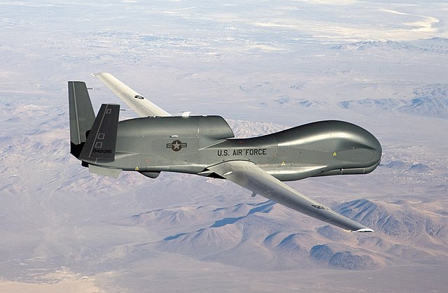
English: An RQ-4 Global Hawk unmanned aircraft like the one shown is currently flying non-military mapping missions over South, Central America and the Caribbean at the request of partner nations in the region. |
| نېټه | |
| سرچينه | http://www.af.mil/shared/media/photodb/photos/070301-F-9126Z-229.jpg |
| ليکوال | U.S. Air Force photo by Bobbi Zapka |
| نورې بڼې | Derivative works of this file: Tasnim Infographic - The Falconry.jpg |
منښتليک:
This image or file is a work of a U.S. Air Force Airman or employee, taken or made as part of that person's official duties. As a work of the U.S. federal government, the image or file is in the public domain in the United States.
|
 |
د دوتنې پېښليک
په يوې نېټې/يوه وخت وټوکۍ چې د هماغه وخت او نېټې دوتنه چې څنگه ښکارېده هماغسې درښکاره شي.
| نېټه/وخت | بټنوک | ډډې | کارن | تبصره | |
|---|---|---|---|---|---|
| اوسنی | ۰۷:۱۵, ۶ مې ۲۰۰۹ | | ۳٬۰۰۰ × ۱٬۹۶۵ (۲٫۹۶ مېگابايټ) | DeffiSK~commonswiki | {{Information |Description={{en|1=An RQ-4 Global Hawk unmanned aircraft like the one shown is currently flying non-military mapping missions over South, Central America and the Caribbean at the request of partner nations in the region.}} |Source=http://ww |
د دوتنې کارېدنه
دا لاندينی مخ د همدې دوتنې سره تړنې لري:
د نړېوالې دوتنې کارېدنه
همدا دوتنه لاندينۍ نورې ويکي گانې کاروي:
- په ar.wikipedia.org کارونې
- مسيرة
- سلاح الجو
- بوابة:طيران/صورة مختارة
- بوابة:طيران/صورة مختارة/5
- آر كيو-4 غلوبال هوك
- بوابة:طيران/أحداث تاريخية/أبريل في الطيران
- بوابة:طيران/أحداث تاريخية/أبريل في الطيران/24 أبريل
- قائمة الطائرات العسكرية النشطة في الولايات المتحدة
- بوابة:الحرب/مقالة مختارة/5
- بوابة:الحرب/مقالة مختارة/أرشيف
- برنامج الصواريخ الإيرانية
- سوم خرداد (نظام دفاع جوي)
- جناح الاستخبارات رقم 181
- 3 خرداد (نظام صاروخي للدفاع الجوي)
- په ar.wikinews.org کارونې
- په azb.wikipedia.org کارونې
- په az.wikipedia.org کارونې
- په bs.wikipedia.org کارونې
- په ca.wikipedia.org کارونې
- په ckb.wikipedia.org کارونې
- په cs.wikipedia.org کارونې
- په da.wikipedia.org کارونې
- په de.wikipedia.org کارونې
- په de.wikinews.org کارونې
- په en.wikipedia.org کارونې
- United States Air Force
- Northrop Grumman RQ-4 Global Hawk
- Surveillance aircraft
- Northrop Grumman
- Portal:Aviation/Selected picture
- Portal:Aviation/Selected picture/23
- User:Germinator15
- User:SunKider/sandbox
- User:Mrteeve/Sandbox2
- 2019 Iranian shoot-down of American drone
- User:Mrteeve/BigExpand
- User:Iamonwikimofo/sandbox/Joint Forces
- User:Iamonwikimofoos/sandbox
- User:Iamonwikimofoos
- په en.wikiquote.org کارونې
- په es.wikipedia.org کارونې
- په et.wikipedia.org کارونې
- په fa.wikipedia.org کارونې
د دې دوتنې نورې نړېوالې کارېدنې کتل.