دوتنه:Blank map of Afghanistan districts.svg

Size of this PNG preview of this SVG file: ۸۰۰ × ۵۸۹ پېکسل. نورې ژورليدنې: ۳۲۰ × ۲۳۶ پېکسل | ۶۴۰ × ۴۷۱ پېکسل | ۱٬۰۲۴ × ۷۵۴ پېکسل | ۱٬۲۸۰ × ۹۴۲ پېکسل | ۲٬۵۶۰ × ۱٬۸۸۵ پېکسل | ۹۱۰ × ۶۷۰ پېکسل.
اصلي دوتنه (SVG دوتنه، نومېنلي ۹۱۰ × ۶۷۰ پېکسل، د دوتنې کچه: ۷۰۰ کيلوبايټ)
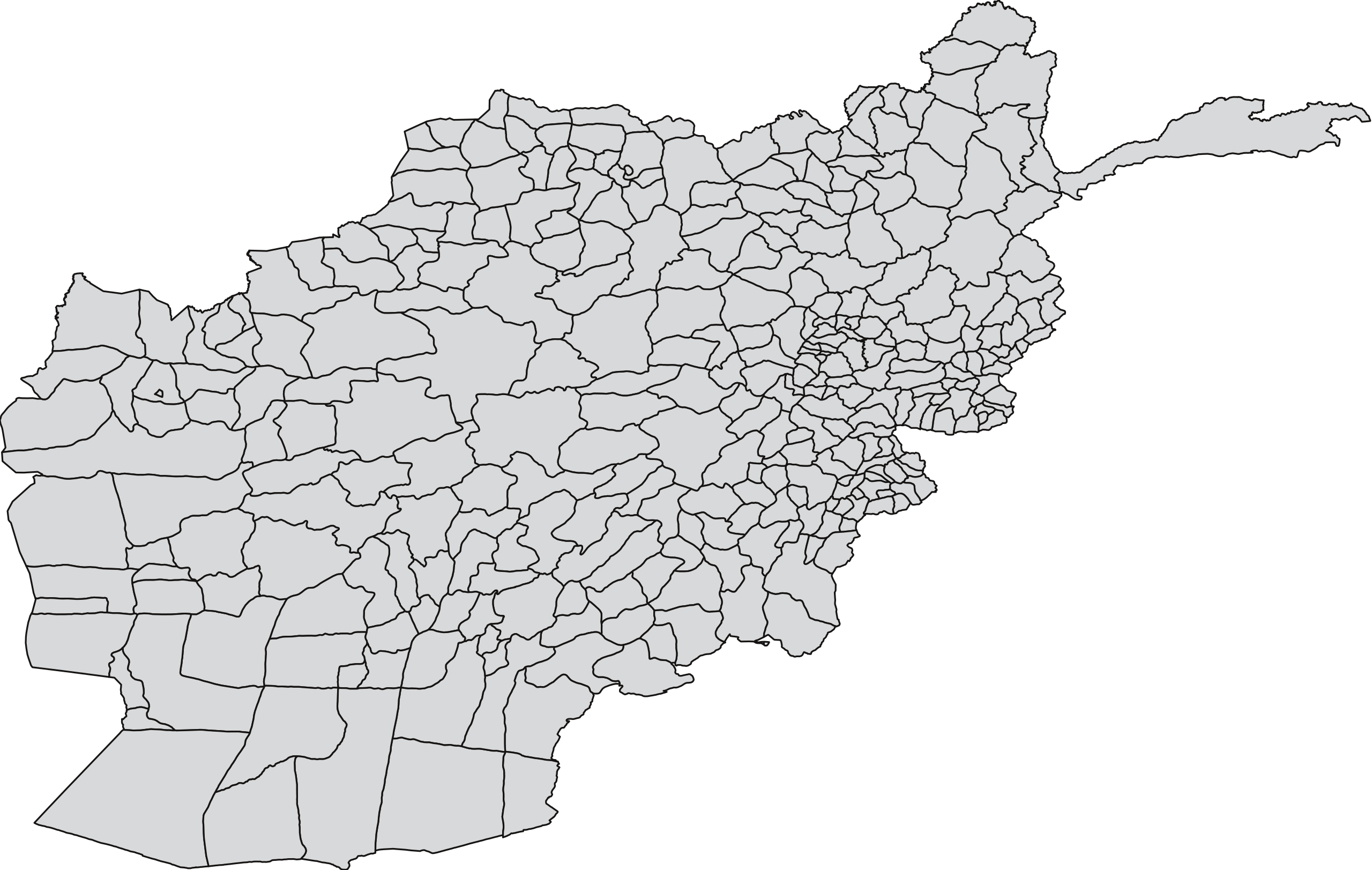
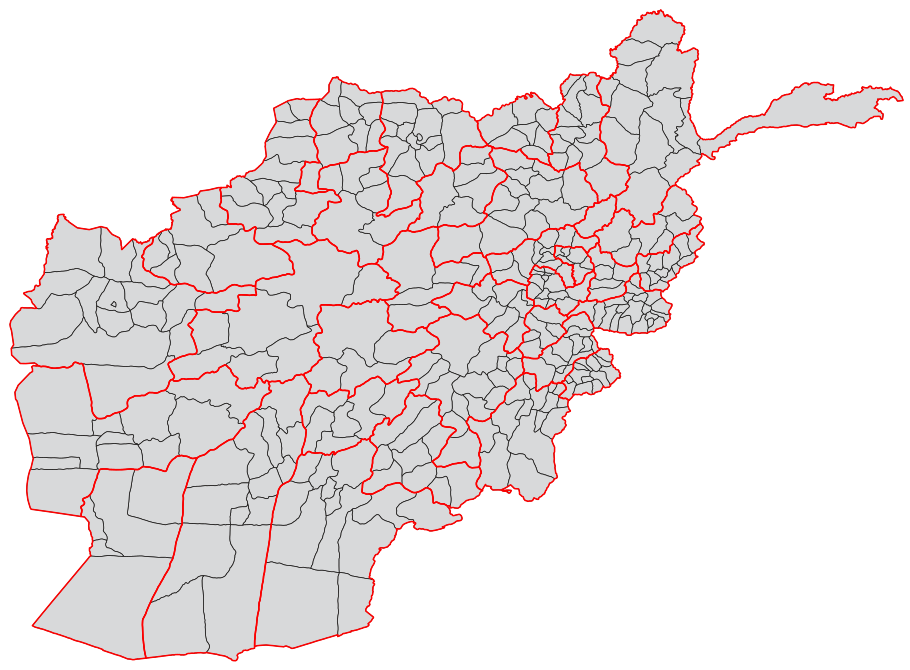
| څرگندونه | A blank map of the districts of Afghanistan. The districts are grouped by province and province borders are shown in red. | |||||
| نېټه | ||||||
| سرچينه |
Map originally from Maplibrary.org who in turn have extracted it from GADM version 0.9 which source the data for Afghanistan as comming from the USGS.
|
|||||
| ليکوال | USGS and Lokal_Profil | |||||
| اجازه (دا دوتنه بيا کارول) |
|
|||||
| نورې بڼې |
|


د دوتنې پېښليک
په يوې نېټې/يوه وخت وټوکۍ چې د هماغه وخت او نېټې دوتنه چې څنگه ښکارېده هماغسې درښکاره شي.
| نېټه/وخت | بټنوک | ډډې | کارن | تبصره | |
|---|---|---|---|---|---|
| اوسنی | ۰۸:۵۵, ۲۱ اکتوبر ۲۰۱۸ | | ۹۱۰ × ۶۷۰ (۷۰۰ کيلوبايټ) | Furfur | Map looked a liitle bit distorted – adjusted it to match Afghanistan_location_map.svg |
| ۱۹:۵۴, ۱ مارچ ۲۰۰۹ |  | ۷۵۰ × ۴۷۵ (۲٫۵۷ مېگابايټ) | Lokal Profil | Added province info | |
| ۱۹:۴۵, ۲۵ فبروري ۲۰۰۹ |  | ۷۵۰ × ۴۷۵ (۱٫۶۸ مېگابايټ) | Lokal Profil | {{Information |Description=A blank map of the districts of Afghanistan. |Source=Map originally from [http://www.maplibrary.org/stacks/gadm/AFG/index.php Maplibrary.org] who in turn have extracted it from [http://biogeo.berkeley.edu/gadm/ GADM version 0.9] |
د دوتنې کارېدنه
دا لاندينی مخ د همدې دوتنې سره تړنې لري:
د نړېوالې دوتنې کارېدنه
همدا دوتنه لاندينۍ نورې ويکي گانې کاروي:
- په ar.wikipedia.org کارونې
- په bn.wikipedia.org کارونې
- په ca.wikipedia.org کارونې
- په de.wikipedia.org کارونې
- په es.wikipedia.org کارونې
- په fa.wikipedia.org کارونې
- په fr.wikipedia.org کارونې
- په id.wikipedia.org کارونې
- په it.wikipedia.org کارونې
- په ja.wikipedia.org کارونې
- په ms.wikipedia.org کارونې
- په new.wikipedia.org کارونې
- په no.wikipedia.org کارونې
- په oc.wikipedia.org کارونې
- په pnb.wikipedia.org کارونې
- ضلع بامیان
- ضلع بلخ
- ضلع انار درہ
- ضلع باکواہ
- ضلع اوبہ
- ضلع ادرسکن
- ضلع بالا بلوک
- ضلع انجیل
- ضلع المار
- ضلع اندخوی
- ضلع آقچہ
- ضلع اشکمش
- ضلع بنگی
- ضلع آرگو
- ضلع آرغنج خواہ
- ضلع اشکاشیم
- ضلع باک
- ضلع برک متال
- ضلع ارچی
- ضلع اسد آباد
- ضلع برکنر
- ضلع اجرستان
- ضلع اسمار
- ضلع اندر
- ضلع آب بند
- ضلع برکہ
- ضلع اندراب
- ضلع الہ ساری
- ضلع بغلان جدید
- ضلع باغران
- ضلع برگ متال
- ضلع بزارک
- ضلع ایبک
- ضلع ارغنداب
- ضلع ارغستان
د دې دوتنې نورې نړېوالې کارېدنې کتل.