دوتنه:GPS Satellite NASA art-iif.jpg

د همدې ليدنې کچه: ۷۴۸ × ۵۹۹ پېکسل. نورې ژورليدنې: ۳۰۰ × ۲۴۰ پېکسل | ۵۹۹ × ۴۸۰ پېکسل | ۱٬۰۰۶ × ۸۰۶ پېکسل.
اصلي دوتنه (۱٬۰۰۶ × ۸۰۶ پېکسل, د دوتنې کچه: ۱۱۱ کيلوبايټ, MIME بڼه: image/jpeg)
لنډيز
| څرگندونه |
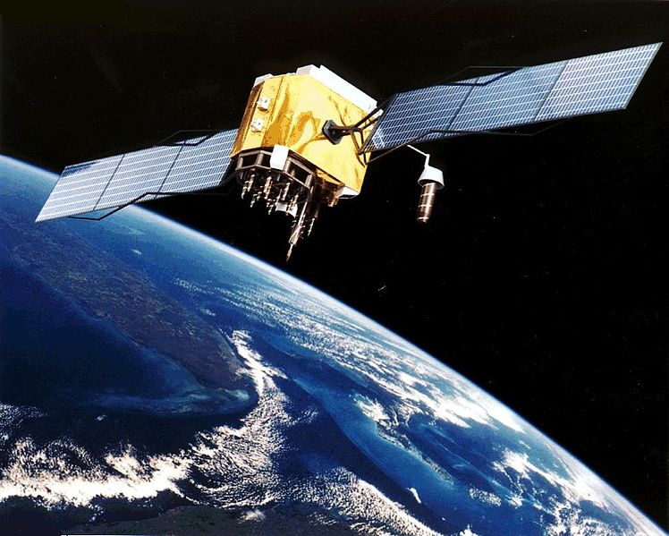
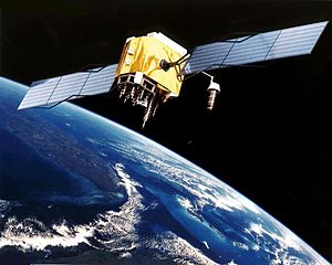
English: Artist's conception of GPS Block II-F satellite in Earth orbit.
Français : Vue d'artiste d'un satellite GPS Block II-F sur orbite terrestre. |
| نېټه | ناڅرگنده نېټه |
| سرچينه | https://www.egraphicbd.com [dead link] (Wayback Machine) |
| ليکوال | NASA |
| نورې بڼې |

منښتليک:
| This file is in the public domain in the United States because it was solely created by NASA. NASA copyright policy states that "NASA material is not protected by copyright unless noted". (See Template:PD-USGov, NASA copyright policy page or JPL Image Use Policy.) | ||
 |
Warnings:
|
د دوتنې پېښليک
په يوې نېټې/يوه وخت وټوکۍ چې د هماغه وخت او نېټې دوتنه چې څنگه ښکارېده هماغسې درښکاره شي.
| نېټه/وخت | بټنوک | ډډې | کارن | تبصره | |
|---|---|---|---|---|---|
| اوسنی | ۲۰:۲۰, ۹ فبروري ۲۰۰۶ | | ۱٬۰۰۶ × ۸۰۶ (۱۱۱ کيلوبايټ) | Michaelfavor~commonswiki | Artist Interpretation of GPS satellite, image courtesy of NASA http://www.navcen.uscg.gov/ftp/gps/ggeninfo/gps-iif.tif |
د دوتنې کارېدنه
دا لاندينی مخ د همدې دوتنې سره تړنې لري:
د نړېوالې دوتنې کارېدنه
همدا دوتنه لاندينۍ نورې ويکي گانې کاروي:
- په af.wikipedia.org کارونې
- په ar.wikipedia.org کارونې
- په ba.wikipedia.org کارونې
- په be.wikipedia.org کارونې
- په bn.wikipedia.org کارونې
- په cs.wikipedia.org کارونې
- په cv.wikipedia.org کارونې
- په da.wikipedia.org کارونې
- په de.wikinews.org کارونې
- په el.wikipedia.org کارونې
- په en.wikipedia.org کارونې
- Navigation
- Dynamic positioning
- Geoinformatics
- Militarisation of space
- GPS signals
- Wikipedia:WikiProject Systems/List of images of systems
- Talk:USA-193
- Help talk:Table/Archive 3
- List of equipment of the United States Armed Forces
- Error analysis for the Global Positioning System
- User:Doggitydogs/GPS
- User:HelpingWorld/sandbox2
- User:Wikiworkr/sandbox
- User:MYBOIIII/sandbox
- Portal:Geodesy
- په en.wikibooks.org کارونې
- په en.wikiversity.org کارونې
- په es.wikipedia.org کارونې
- په es.wikinews.org کارونې
- په et.wikipedia.org کارونې
- په fa.wikipedia.org کارونې
- په fi.wikipedia.org کارونې
د دې دوتنې نورې نړېوالې کارېدنې کتل.